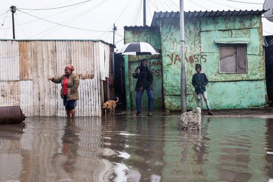
Africa-Press – South-Africa. Rain, wind and snow will continue to lash the Western Cape as a cold front makes landfall on Friday.
The bite of the cold front will be felt in the south-western parts of the province at first and is likely to cause widespread showers and rain, according to the South African Weather Service (SAWS).
Light snowfall is expected over the mountains of the Western Cape and south-western Northern Cape. This will mainly fall in the evening, the weather service added.
“Strong to gale-force winds are also possible along the south-western, southern and south-eastern coastline with very rough sea conditions. It will also be windy over the central, southern and western interior,” the SAWS said.
Several wind- and wave-related impact-based warnings have been issued.
A warning is in place for strong to gale-force winds (60–80km/hr) between Saldanha Bay and Plettenberg Bay, persisting into Saturday.
The municipality said firefighting teams were in the Matjiesrivier area, after the fire broke out on privately owned land and spread to Cape Nature land.
“Two fronts of the fire have been contained but one front is being spread by heavy winds. The immediate priority is to protect structures which are in the path of the fire,” the Oudtshoorn municipality said.
A warning is in place for swells, with wave heights of up to six metres, between Saldanha Bay and Cape Agulhas on Friday, spreading to Alexander Bay and Plettenberg Bay on Friday evening. The wave heights are expected to increase to up to eight metres and the conditions are expected to persist into Sunday.
A weather advisory is also in place for cold and windy conditions, with the temperature expected to drop below 10 degrees Celsius in parts of the Northern Cape and Western Cape.
National Sea Rescue Institute spokesperson Craig Lambinon said the NSRI was appealing to the public and maritime community to exercise caution amid the heavy sea swells and strong winds.
The NSRI appealed to paddlers, sailors and boaters to postpone water activities if possible.
Lambinon said:
He also urged shoreline anglers, bathers and hikers along the coastline to be cautious.
The Western Cape Disaster Management Centre’s Schalk Carstens said that while some areas were experiencing strong winds, no weather-related incidents were reported.
According to City of Cape Town mayoral committee member for urban mobility Rob Quintas, some roads were affected by isolated flooding and standing water due to blocked stormwater drains.
He said reports were being addressed and resolved.
“Low-lying areas that are on water tables are also affected, but this is the usual case when there is a prolonged winter with higher-than-average heavy rainfall,” he said.
City of Cape Town Disaster Risk Management Centre spokesperson Charlotte Powell said the metro had no incidents as a result of the heavy rains.
For More News And Analysis About South-Africa Follow Africa-Press


