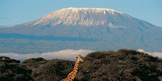
AfricaPress-Tanzania: TANZANIA’s two highest peaks, Mount Kilimanjaro and Mount Meru as well as Ngurdoto Crater found within the Arusha National Park, are set to be listed as global geoparks.
Herman Batiho, the Northern Zone senior conservation commissioner for the Tanzania National Parks told this paper here yesterday that the Geopark Nomination Dossier for tourism horspots has already been prepared and sent to the United Nations Educational, Scientific and Cultural Organization (UNESCO).
UNESCO defines a geopark as a unified area that advances the protection and use of geological heritage in a sustainable way, and promotes the economic well-being of the people who live there. The global dimension is a geological heritage of international significance for such areas, it says.
“Kilimanjaro is a straight case, with the mountain being already listed as a UNESCO global hemisphere reserve,” the conservator said, noting that geological features found in the Arusha National Park will be next to attain this status, already recognised for Serengeti National Park and Ngorongoro Conservation Area.
Mount Kilimanjaro is a dormant volcano featuring three volcanic cones the most cited being Kibo, Africa’s highest peak at 5,895 meters above sea level, Mawenzi is the second and of late experts make reference to Shira peak. The giant land feature is lifeline to millions of people residing at its foot especially because it serves as East Africa’s largest water reservoir, naturally supplying the precious resource to Kilimanjaro, Tanga and Coast regions, as well as the entire Rift Valley zone in Kenya, stretching as far as Nairobi.
For its global geopark status, Arusha National Park has fielded Mount Meru, also a dormant volcano, and a reliable water source peaking at 4562 meters above sea level. It is second highest mountain in Tanzania, and it is said to have last erupted in 1910.
Other geological formations to be included under the Meru Geopark within the Arusha National Park are the Ngurdoto Crater and Momella Lake, for the areas’ outstanding natural ecological features.
Albert Mziray, the Assistant Commissioner of Conservation at Arusha National Park, said that UNESCO Geoparks require local community participation, hence befits the park as it is surrounded by 88 villages.
“The villagers benefit from a number of community targeting development projects covering health, education and assisted income generating ventures,” he said.
Tanzania is the only country south of the Sahara where UNESCO has endorsed geoparks, with Morocco’s M’Goun mountain zone, located 330 kilometers from the capital, Casablanca.
The other local UNESCO geopark is the Ngorongoro-Lengai zone, encompassing the active Oldonyo Lengai volcano, the third highest free-standing mountain in Tanzania and the Ngorongoro Crater area.
There are also moving sand dunes, Nassera Rock, Lake Natron, Laetoli, Olduvai and Olkerian gorges, among other features of this Arusha Region.conservation zone.
Once endorsed, the proposed Meru-Kilimanjaro Geopark under the Tanzania National Parks (TANAPA), joining the Ngorongoro-Lengai Geopark which UNESCO adopted in 2018 and is placed under the Ngorongoro Conservation Area Authority.
Global Geoparks are single, unified geographical areas with landscapes of international geological significance, being managed under the concept of protection, education and sustainable development.
Geoparks combine conservation with sustainable development while also involving local communities, an increasingly popular approach to conservation. At present, there are 169 UNESCO global geoparks in 44 countries.
Geopark tourism is popular among visitors from the Far East (China), the Middle East and other parts of Asia. Tanzania is set to benefit from this development in its being attractive to this market, holding large populations and spending power.


